Sunset fire grows to 3,208 acres, while Lightning Creek fire holds around 2,500 acres
August 20, 2025
By Zach Hagadone Reader Staff
The Sunset fire northeast of Athol grew to 3,208 acres as of the Aug. 20 morning update from the Northern Rockies Complex Incident Management Team, burning with 4% containment across a long swath of public and private land on the western slope of Lake Pend Oreille.
According to the most recently available information, the wildfire perimeter stretched from Sunset Road at Careywood Creek in the south, eastward to the shoreline and north through the Evans Landing and Maiden Rock areas to Pearl Creek on Blacktail Mountain just south of Talache Landing, with smaller spot fires reported along Talache Creek.
Forest closure areas are in effect throughout the Blacktail Mountain Roadless Area, as well as northeast of Talache Road almost to Garfield Bay and covering almost all of the acreage from Green Bay to Mineral Point to the east and north nearly to Camp Bay.
There were 546 personnel on the fire as of press time, with water scoopers making regular passes through the area, drawing water from the lake to help douse the flames.
While Hotshots, Type 2 hand crews, engines and heavy equipment are all being deployed to reinforce firelines along the western flank of the fire, Hotshots and Type 2 hand crews are working to establish firelines on the northern flank.
In addition to water scoopers, helicopters are assisting with water drops on the southern, western and northern flanks, and structure protection teams are active where needed along Talache Road and Butler Creek. Watercraft are being used to deliver crews into remote areas on the lakeshore.
According to the report, daytime infrared flights are ongoing at 18,000 feet to identify pockets of heat, which are also being located with a lower-altitude drone equipped with infrared sensing.
The three-tiered “Ready, Set, Go” evacuation schedule is in effect for large areas surrounding the fire.
At the “Ready” level, residents are to establish an evacuation plan and start organizing what they need to leave the area if the fire threat increases.
The “Set” level is to finalize preparations to leave before imminent threat and at “Go” status, residents should leave immediately “due to an imminent life threat,” according to the guidance from the Bonner County Sheriff’s Office and Emergency Management department.
County officials have issued a brochure with further information about the three levels of evacuation, including a form to be filled out and left attached to the primary entrance of individuals’ homes before evacuation, so that emergency resources can more quickly contact them if needed.
In addition, an emergency preparedness checklist is available at bonnercountyid.gov/bcem-checklist. See the map on this page for more information, or go to bonnerso.org/official-sunset-fire-updates for ongoing news releases and notices, including how to sign up for alerts from the Idaho Department of Lands and access the Inciweb page for the Sunset fire. Regular updates also come via the BCSO through the Nixle emergency alert system. Sign up for Bonner County Nixle alerts by texting 888777 and entering your zip code.
The sheriff’s office also reported that Selkirk Fire, Rescue and EMS has issued a no-burn order for areas east of Highway 95.
Meanwhile, an evacuation center is available at the Cocolalla Bible Camp (209 Cocolalla Loop Road, in Cocolalla) for displaced residents and the Bonner County Fairgrounds (4203 N. Boyer Road, in Sandpoint) are available to shelter evacuated livestock on a limited basis.
On behalf of the fair organization, BCSO released further guidance on animal evacuation policies Aug. 20, including that no evacuees are allowed to camp at the fairgrounds — unless they visit camplife.com and rent a campsite space — and no birds, dogs, cats, reptiles or “other speciality pets” will be accepted. Rabbits, goats, sheep, horses, cattle, pigs, alpacas and llamas will be accepted, per space constraints. All evacuated animals must be checked in and paperwork filled out. If dropped off and unattended, animals without the proper check-in materials will be considered abandoned and turned over to the BCSO. That also goes for animals that are left uncared for or unclaimed.
Check-in hours are Monday-Friday, 8 a.m.-4 p.m. at the Boyer Road entrance. If arriving after hours, call 208-920-9680 to arrange for dropoff.
The Aug. 20 fire report stated that temperatures are due to increase while dry conditions persist, likely increasing fire activity and resulting in smoky skies.
“Flanking and torching fire behavior will increase today in areas with isolated residual heat, and heavy fuels will continue to burn,” fire managers stated on Aug. 20. “Continued drying of fuels, higher temperatures and lower relative humidities will result in increased potential for fire activity.”
Difficult terrain has also challenged crews’ ability to contain the fire, with officials saying at an Aug. 18 community meeting in Sandpoint that a combination of the area’s remoteness and steep shoreline environment make the Sunset fire an especially complex incident.
The cause of the fire, which began on Aug. 13, remains under investigation.
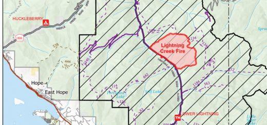
The other major fire burning in Bonner County is across the lake, covering 2,515 backcountry acres about nine miles north of Clark Fork.
According to the most recent update, issued by the U.S. Forest Service on Aug. 17, containment of the Lightning Creek fire was at 25%, with 109 personnel on-site including two engines, one water tender, five pieces of heavy equipment and one hand crew.
Management of the fire, which began July 30 and was caused by lightning strike, was transferred Aug. 18, with the Northern Rockies Incident Management Team handing operations over to the Idaho Panhandle National Forests.
Activity on the Lightning Creek fire was described as “minimal,” though the forecast of higher temperatures, lower humidity and winds will increase the potential for greater growth, as with the Sunset fire.
A temporary flight restriction remains in place throughout both the Sunset and Lightning Creek fire areas, which prohibits operating aircraft — including drones — without permission. Boaters are also strongly cautioned to avoid the waters adjacent to the Sunset fire, which are being used by multiple aircraft for fire suppression.
For more information and updates on the Sunset fire, go to inciweb.wildfire.gov/incident-information/idids-sunset-fire, call 208-990-1881 or email [email protected].
For more on the Lightning Creek fire, go to inciweb.wildfire.gov/idipf-lightning-creek-fire or call 208-557-8813.
Want to support independent local journalism?
The Sandpoint Reader is our town's local, independent weekly newspaper. "Independent" means that the Reader is locally owned and operated by people who were born and raised in Sandpoint. The Reader is owned by Publisher Ben Olson, Editor-in-Chief Zach Hagadone and Senior Writer Soncirey Mitchell. Sandpoint Reader LLC is a completely independent business unit; no big newspaper group or corporate conglomerate or billionaire owner dictates our editorial policy. And we want the news, opinion and lifestyle stories we report to be freely available to all interested readers - so unlike many other newspapers and media websites, we have NO PAYWALL on our website. The Reader relies wholly on the support of our valued advertisers, as well as readers who voluntarily contribute. Want to ensure that local, independent journalism survives in our town? You can help support the Reader for as little as $1.
TIMBER WARS: Six-part series, February-November 2022. GO READ IT»
WHERE ARE THE WORKERS?: Five-part series, September-October 2021. GO READ IT»
THE AMERICAN REDOUBT: Seven-part series, November-December 2017. GO READ IT»
STANDOFF AT RUBY RIDGE: 25 Years Later. Five-part series, August-September 2017. GO READ IT»
Curious about what media the locals use? Check our 2018 Local Media Survey. GO SEE »
Sandpoint in Pictures
Filmmaker Jimmy Matlosz of the Idaho Film Company has made a series of mini documentaries about influential Sandpoint locals, including the late Dann Hall and Erik Daarstad as well as icons Diane Michaels and Dan Shook. He is currently working on a series of interviews connected to the history of the Panida Theater. Jimmy is a 30-year veteran filmmaker who's work can be seen at dpmatlosz.com.
Meet the Reader
Ever wonder who makes the Reader happen? Here's a behind-the-scenes look pieced together by summer 2017 intern McCalee Cain in which Ben, Cameron and Lyndsie explain what exactly about the Reader keeps them coming back to their shabby (but well-loved) office each week.